Innovative Device Tracks Air Pollution from Space
NASA has released the initial data maps from an innovative new device developed to track air pollution from space. The maps display elevated concentrations of significant pollutants, such as nitrogen dioxide, which is typically generated when fossil fuels are combusted for transportation, power production, and various industrial processes, as well as during wildfires. The data identifies several urban regions in the United States, Canada, Mexico, and the Caribbean as air pollution epicenters, especially at specific times throughout the day. These findings can be vital in crafting strategies and policies to mitigate pollution in these areas, as they reveal the spatial and temporal patterns of air pollution. Moreover, by continuously monitoring air quality from space, city planners and environmental policy makers can better pinpoint the sources of pollution and implement targeted efforts to reduce emissions and improve public health.
Elevated Pollution Concentrations
The organization mentioned that the pollution maps “display elevated concentrations of nitrogen dioxide over cities in the morning, and increased levels of nitrogen dioxide above major highways.” Pollutants in these regions dispersed during the early afternoon but later intensified when cities encountered their second rush hour. This pattern of pollution fluctuation highlights the significant impact of vehicular traffic on air quality in urban areas and along busy highways. As a result, there is a growing need for city planners and policymakers to adopt sustainable transportation methods, such as public transit and electric vehicles, in order to alleviate these recurring air pollution issues.
Identifying Pollution Hotspots
NASA created these air pollution maps using data gathered on August 2, which identified numerous U.S. cities and their surrounding areas, including Dallas, Houston, New Orleans, New York, Philadelphia, and Washington, D.C., with high levels of nitrogen dioxide. The maps reveal the severity of the air pollution problem in these metropolitan regions, emphasizing the need for further research and action to reduce nitrogen dioxide levels. By identifying the sources and assessing the impact of these pollutants, authorities and researchers can implement targeted measures to improve air quality and safeguard public health.
Tracking Air Pollution with TEMPO
The instrument in charge of observing air pollution is the Tropospheric Emissions: Monitoring of Pollution (TEMPO) light analyzer. The device was developed through a partnership between the NASA Langley Research Center and the Smithsonian Astrophysical Observatory. This innovative technology enables scientists to continuously monitor air quality in real-time, providing invaluable data to better understand the factors contributing to poor air quality. With the data gathered by TEMPO, researchers aim to facilitate more effective strategies and policies for mitigating air pollution and its impacts on human health and the environment.
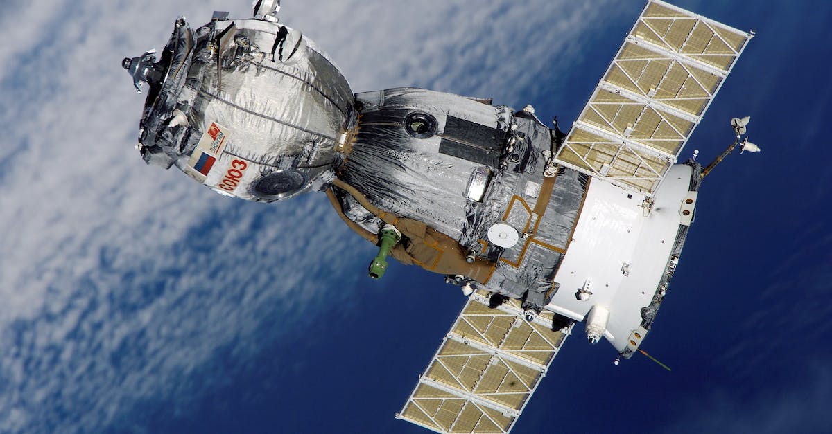
TEMPO’s Launch and Monitoring Capabilities
In April, a SpaceX Falcon 9 rocket launched TEMPO into orbit, along with a communications satellite, and it now monitors Earth from 22,000 miles above the equator. TEMPO, short for Tropospheric Emissions: Monitoring Pollution, is now a valuable tool for environmental scientists to study air quality and pollution patterns in unprecedented detail. From its vantage point, TEMPO is able to continuously measure key air pollutants across North America, providing vital information for governments, industries, and researchers seeking to implement effective solutions to combat pollution and improve overall air quality.
First Continuous Space-Based Air Quality Monitor
NASA states that the TEMPO spectrometer is the first-ever space-based instrument designed to continually observe air quality across North America at a resolution of just a few square miles. The technology will enable the monitoring of air pollutants in urban and rural areas, providing valuable information for effective environmental policymaking and management strategies. By collecting precise data on air quality and identifying sources of pollution, TEMPO will play a critical role in addressing pressing environmental concerns and safeguarding public health.
Measuring Air Pollutants with TEMPO
By measuring sunlight as it reflects off the Earth’s surface, clouds, and atmosphere, TEMPO helps to establish the amount of gas present since atmospheric gases absorb sunlight. This absorption process reveals the concentration and distribution of various pollutants, such as nitrogen dioxide, ozone, and formaldehyde. As a result, TEMPO provides invaluable data for monitoring air quality, enabling researchers and policymakers to develop effective strategies for reducing atmospheric pollution and mitigating its impact on human health and the environment.
Challenges in Identifying Nitrogen Dioxide
For TEMPO to identify nitrogen dioxide, the pollutant must be situated above the clouds, as the instrument depends on visible sunlight to collect data and take measurements. The presence of clouds can obstruct the sunlight, making it difficult for TEMPO to accurately measure the nitrogen dioxide levels. However, researchers are developing methods to help account for cloudy days to ensure that reliable data is still collected and monitored for air quality assessment.
Monitoring Limitations and Valuable Insights
In NASA’s visual representations, cloudy regions appear as omitted data, and TEMPO can solely record air pollution levels during daylight hours. As a result, collecting accurate data on air pollution during nighttime or in locations with persistent cloud cover becomes a significant challenge for researchers. Nonetheless, TEMPO’s ability to monitor air quality trends and patterns during the day offers valuable insights for scientists, which can be used to develop better strategies for reducing pollution and protecting public health.
FAQs: Innovative Device Tracks Air Pollution from Space
What is the main purpose of the TEMPO device?
The main purpose of the Tropospheric Emissions: Monitoring of Pollution (TEMPO) device is to track air pollution from space, monitor air quality, and provide crucial data to better understand the factors contributing to poor air quality. This data is valuable for researchers and policymakers in implementing effective strategies and policies to mitigate air pollution and its impacts on human health and the environment.
What is nitrogen dioxide and why is it a significant pollutant?
Nitrogen dioxide is a major pollutant produced when fossil fuels are combusted for transportation, power production, and various industrial processes, as well as during wildfires. Elevated concentrations of nitrogen dioxide can have detrimental effects on air quality and ultimately impact public health and the environment.
What sustainable transportation methods can help reduce air pollution?
City planners and policymakers can adopt sustainable transportation methods, such as public transit and electric vehicles, to reduce the impact of vehicular traffic on air quality and alleviate recurring air pollution issues in urban areas and along busy highways.
How does TEMPO measure air pollutants?
TEMPO measures air pollutants by analyzing sunlight as it reflects off the Earth’s surface, clouds, and atmosphere. Atmospheric gases, such as nitrogen dioxide, ozone, and formaldehyde, absorb sunlight, and this absorption process reveals their concentration and distribution. This information is crucial for monitoring air quality and developing effective strategies for reducing atmospheric pollution.
What are the challenges of identifying nitrogen dioxide with TEMPO?
One of the challenges TEMPO faces in identifying nitrogen dioxide is that the pollutant must be situated above the clouds, as the instrument relies on visible sunlight to collect data and take measurements. The presence of clouds can obstruct sunlight, making it difficult for TEMPO to accurately measure nitrogen dioxide levels. However, researchers are working on methods to account for cloudy days to ensure reliable data collection and monitoring of air quality.
What are some limitations of TEMPO’s monitoring capabilities?
Some limitations of TEMPO’s monitoring capabilities include an inability to record air pollution levels during nighttime and the omission of data in cloudy regions due to sunlight obstruction. Nevertheless, TEMPO’s ability to monitor air quality trends and patterns during daylight hours offers valuable insights for scientists to develop better strategies for reducing pollution and protecting public health.
First Reported on: cbsnews.com
Featured Image Credit: Photo by Pixabay; Pexels; Thank you!